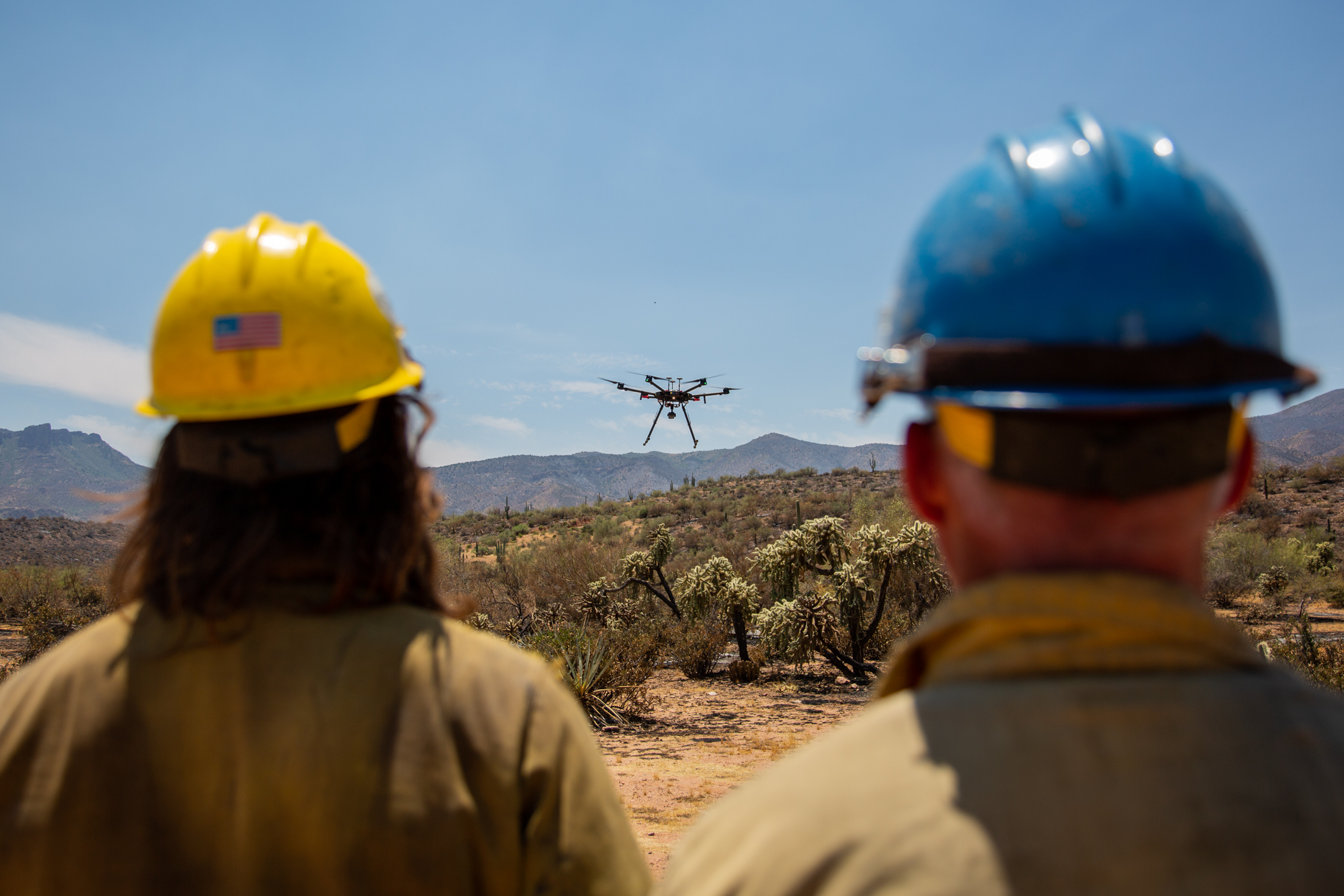
MIAMI, Ariz. — The hum of aerial drones was a soundtrack to the month it took to contain the Woodbury Fire in June, which burned its way to becoming the fifth largest wildfire in Arizona history.
The fire burned nearly 124,000 acres of the Superstition Wilderness and the Tonto National Monument. The difficult terrain made putting firefighters on the ground a potentially deadly risk.
“Our main value is firefighter safety and public safety,” said Dick Fleishman, a fire information officer. “We’re not going to put people in this ground where we can barely get them in-and-out of there.”
Leaving the creation of situational awareness, scale mapping and infrared imagery to Unmanned Aerial Systems, also known as drones.
In the last eight years, the number of federal drone flights has grown from 260 in 2010 to 10,342 last year, according to data from the Department of Interior. In Arizona, drone usage has increased by 184% in the last two years.
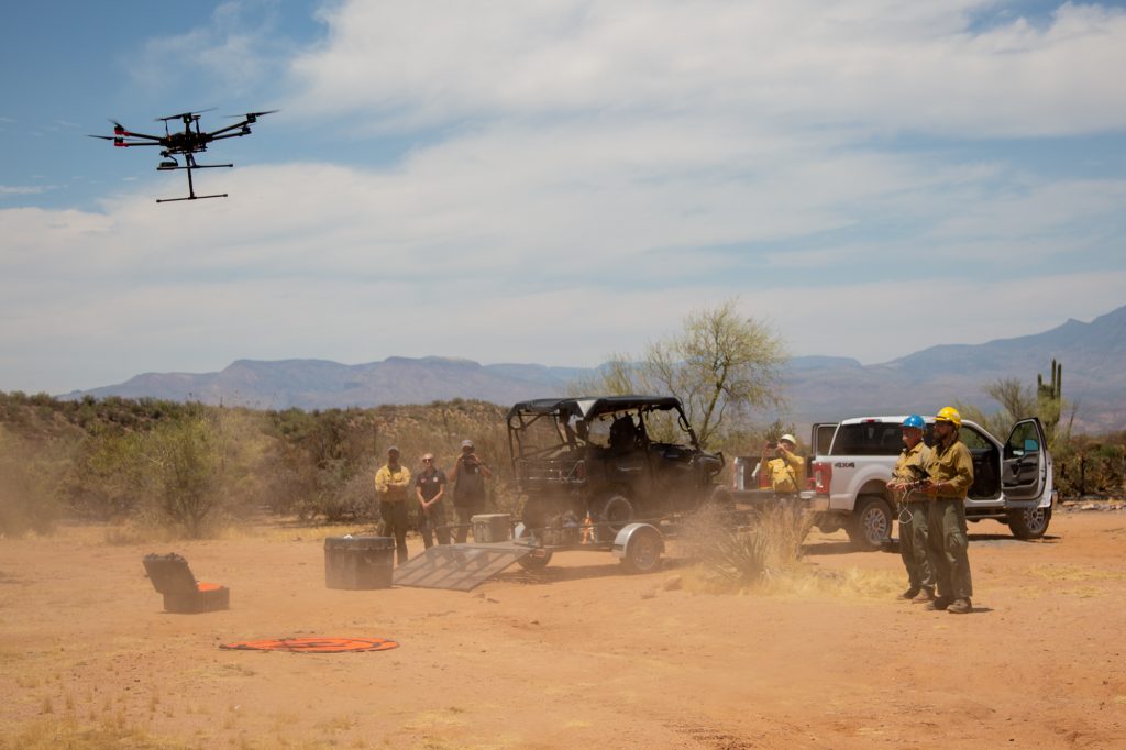
Justin Baxter, a drone fire operations specialist, and his three-man team flew a Matrice 600 (M600) during the Woodbury Fire.
“We’ve been doing a lot on this fire with infrared work just based on how rugged the terrain is,” Baxter said.
Assessing wildfire burned land was one of Baxter’s most common missions during the Woodbury Fire. The infrared and normal cameras attached to the M600 allow operators to compare land temperature as they monitor burn zones for hotspots, which have the potential to ignite new fires.
“The drones are not putting out the fires,” Baxter said. “Somebody still needs to go in there and put it out. But we can mitigate some of the risk, some of the exposure and identify areas of concern a little bit sooner.”
New technology now allows drones to not only spot fires but start them.
Attachable infrared cameras and Plastic Sphere Dispensers equip drones to ignite and monitor backburns, a firefighting tactic used to reduce flammable brush in an area that has the potential to fuel an oncoming wildfire.
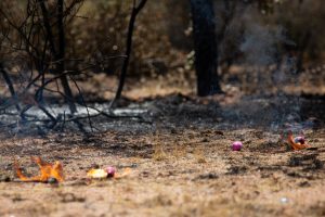
The dispensers drop what Baxter refers to as “ping pong balls” filled with two chemicals that combine to ignite small fires. The drones then monitor these fires as they burn brush, letting firefighters focus on other mitigation and suppression techniques during an active wildfire.
“Drones are a new technology that we’re trying to implement,” said Ryan Berlin, a mitigation and education specialist who was flown in from Idaho for the Woodbury Fire. “We’re still in the infancy of the drones.”
As of 2018, the Bureau of Land Management had 531 drones and 359 operators in its service and provided support during earthquakes, wildfires, hurricanes, volcanic eruptions, animal migrations and search and rescues.
According to the Department of Interior’s Unmanned Aerial Systems Program 2018 Use Report, the 10,342 flights of 2018 totaled 1,785 hours in air, a more than 100% increase in both flights and hours in air from 2017. These flights occurred in 42 states and at least two territories, with more than half of the flights taking place in Hawaii, Oregon, Alaska, Colorado and Idaho.
Arizona had the eighth-most amount of drone flights in 2018, with 570. While statistics on the number of drone flights in 2019 won’t be available until the end of the year, drone usage in Arizona is likely to increase, as this fire season has already burned more land than in all of 2018, according to data from the National Interagency Fire Center.
At the end of 2018, President Donald Trump signed an executive order, which promoted the Department of Interior’s search for new wildfire management, mitigation and suppression techniques. One of the provisions called for agencies to “maximize appropriate use of unmanned aerial systems” — drones — in wildfire fighting and recovery.
With support from the White House and data showing increasing interest in federal drone usage, Baxter looks forward to seeing the program grow.
“I hope that this tool is just like the chainsaw. You’re going to have the EMT that carries a first aid kit. The sawyer that carries the chainsaw and the UAS pilot that carries the UAS,” Baxter said. “Instead of exposing a helicopter pilot to a recon flight or a captain of a crew to hike a ridge nobody’s ever been up. Give them give them the tools to make their job just a little bit safer.”

Anton L. Delgado is a senior at Elon University where he studies journalism and international and global studies. At Elon, he serves as the managing editor of the school newspaper and as a multimedia journalist for Elon News Network. Delgado spent spring 2019 in Morocco as a news correspondent for Morocco World News. He has previously worked for Save the Children Jordan and Town&Country Philippines. Delgado dreams of working as an investigative journalist in conflict zones. View Delgado’s work here.